Editor’s note: This is part of an occasional series in which reporters drop in on interesting classes at the Whiting School of Engineering. Suggestions are welcome. Contact Lisa Ercolano.
The course: Geostatistics: Understanding Spatial Data (570.454)
3 credits. This course is being offered for the first time at JHU this semester.
The instructor: Scot Miller, assistant professor in the Department of Environmental Health and Engineering. Miller came to JHU in January from his post-doctoral fellowship in the Department of Global Ecology at the Carnegie Institution at Stanford University. He earned his doctorate at Harvard. Miller studies greenhouse gases, air pollution, and does atmospheric modeling.
Why Miller created the class: Environmental scientists increasingly have access to large quantities of data (e.g., remote sensing data from satellites or demographic/behavioral data scraped from the internet), and there is an increasing trend toward mining “big data” to better understand the environment. Furthermore, much of this data is geospatial; it is collected from different locations and/or different times. In creating this class, Miller sought to give students the quantitative tools to understand these large, geospatial datasets and elucidate what they can tell us about the environment. Please note that these tools are not relevant only to environmental scientists, but also to economists, political scientists, public health researchers, and anyone who works with geospatial data.
Pre-requisites: An introductory course in statistics is recommended. Knowledge of a scientific programming language (e.g., Matlab, R, or Python) will also be helpful.
Meeting time: 10 to 10:50 a.m., MWF, Ames Hall
Syllabus: Spatial and geographic datasets are becoming increasingly common with improvements in data collection technologies. For example, satellites are able to collect more and more types of earth/environmental data, and web technologies (e.g., social media and e-commerce) provide vast new datasets on social, economic, and public health phenomena. In this course, students draw examples from a wide variety of academic disciplines, including environmental engineering, earth science, public health, and political science, to learn how to quantitatively analyze, model, and predict spatial and spatiotemporal phenomena.
Course work: This class requires a final project and one write-up. Active class participation is encouraged.
Required reading: No required textbook; relevant journal articles will be assigned.
Overheard in class: “What our data shows us is that 25 percent of all methane emissions in the United States come from three states: Texas, Oklahoma, and Kansas. These are likely from oil and gas withdrawals, and agriculture. One of the things that the data indicates is that a big percentage of methane emissions are human caused – much more than we thought. That can be depressing. But the flip side of it is that we can also do something about this.” – Scot Miller, assistant professor.
Students say:
“I signed up for this class to gain the analytical skills necessary to do environmental science research for my future career and grad school. I also wanted to learn how to apply statistical tools to solve real world problems. This class would be useful to any majors that study large quantities of data with spatial or temporal patterns. Environmental engineers, earth and planetary scientists, public health majors, applied mathematicians, ecologists, GECS majors and others could all benefit from this class.” – Erica Johnston, senior, earth and planetary sciences major
“Prof. Miller always starts with a clear and concise description of what we are going to learn from each lecture. My favorite part of this class [is] the problem sets. I find the problem sets are doing a great job of getting me to understand how to use all the geostatistics tools like variogram, kriging, inverse modeling and so on,” Mingyang Zhang, master’s student in environmental health and engineering.
“Geostatistics is important for my PhD research on air pollution and meteorology in the Eastern United States. I had hoped that, by taking this class, I could add some tools to my toolbox by learning more about spatial statistics and inverse modeling as they pertain to the geosciences. I enjoy the real-world examples that [Professor Miller] goes through in class and the problem sets. Although they’re a lot of work, they’ve taught me more about applications for what we’ve learned about beyond what I can learn in lecture.” – Gaige Kerr, PhD candidate in earth and planetary sciences.
-

Dobbs, a leading member of the Blue Key Society and former Student Government Association Senate president, will address his fellow graduates on May 22.
-
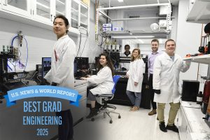
'U.S. News & World Report' ranks Whiting School No. 13 overall, biomedical engineering No. 1 in the nation.
-
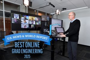
Hopkins Engineering Online Graduate Master's Programs Continue to Rank Among America’s Best
CategoriesSix Whiting School of Engineering online graduate programs are among the top 10