The proposed Red Line transit project could shorten people’s commutes and significantly improve job access within the city, according to a new simulation created by Johns Hopkins University data scientists.
“Our model can show you how long it would take someone to get from any point A to any point B in Baltimore, with and without the Red Line,” said author Fadil Santosa, an applied mathematician known for his work using math for industrial applications and to optimize design. “The numbers we found surprised us, not just how many jobs would become more accessible, but how it specifically could help many of the people in the city who need it the most.”
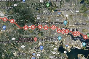
The Red Line, as proposed, is a 14-mile stretch of new rail line that would run East and West, connecting people who live in communities on either edge of Baltimore with jobs downtown and in the southeastern parts of the city. It would connect with the city’s existing rail and transit lines.
The Johns Hopkins team created a model to analyze the potential impact the Red Line could have on job accessibility, meaning the ability of people who live in Baltimore to get to jobs in the city and parts of Baltimore County in a reasonable amount of time—45 minutes or less.
Combining transit and Census data, the team built a model that simulates both how the Red Line would change people’s commute times and how those new commute times could change the city’s overall job accessibility rating. They also factored in data on neighborhood income levels and job centers.
The model assumes the new rapid transit system would start at 7 a.m. daily and move through town at 20 miles per hour with an 8-minute-long headway between trains.
Key findings:
- Simulations show people living in West and East Baltimore could shave seven to 21 minutes from their commutes.
- An estimated 20% of the population working in mid-to-low-income jobs within the Red Line’s service area will see a 50% increase in job accessibility, meaning they would get to work in 45 minutes or less. A subset of these residents would be able to get to work in 30 minutes or less, still seeing the 50% increase in job accessibility.
- The Red Line particularly amplifies job accessibility for communities on the city’s east and west sides, including the neighborhoods of Edmondson Village, Clifton Park, Belair-Edison, Greater Rosemont and Mondawmin.
- Additional transit routes connecting to Red Line stations could extend the commuting benefits to communities beyond those within walking distance of it, enhancing its overall impact on the city’s job accessibility.
The team simulated how the Red Line would change commute times for hypothetical residents in different parts of the city:
Commuting from Greater Rosemont to University of Maryland Hospital: It would take someone living at 2916 Riggs Ave., about 45 minutes to get to work now, taking two different busses and doing a fair bit of walking. With the Red Line it would take about 35 minutes, including a 14-minute walk to the train and an 11-minute walk from the train to the hospital.
Franklintown to downtown: To get from 5048 Carmine Ave., to the 200 block of West Pratt Street downtown would now take someone just over an hour, 64 minutes, taking a combination of three busses and walking. With the Red Line it would take about 43 minutes, including walking to a bus that would take him to a Red Line stop.
Canton to downtown: Getting from 220 S. Haven St. to 250 West Pratt St. now takes about 36 minutes by walking and taking one bus. With the Red Line it would take about 29 minutes, including a 10-minute walk to get to the Red Line stop from and a short walk to the workplace.
Southwest Baltimore to Belts Logistics Services in East Baltimore: Traveling from 3600 W. Franklin St. to 608 Folcroft St., now takes 66 minutes, walking and taking two busses. It would take about 55 minutes with the Red Line, which also includes walking and a short bus ride.
“The Red Line plays a crucial role in bridging the gap between residential areas with a high density of mid-to-lower income workers and the job centers distributed across the city,” the authors conclude. “By enhancing job accessibility, the Red Line potentially contributes to improving the economic mobility and living standards of mid-to-lower income individuals in Baltimore.”
The team included: Yangxinyu Xie, PhD candidate at the University of Pennsylvania; Elizabeth O’Reilly, an assistant professor of Applied Mathematics and Statistics at Johns Hopkins, and James Pizzurro, a software engineer with the Adherence, Reliability, and Integrity Evaluation System (ARIES) transit project.