


In recent decades, archaeologists have turned to high-tech tools, such as remote sensing, to give them a picture of where the world’s historical and cultural treasures reside, buried beneath the Earth’s sand, soil, water, and other cover. But even this 21st-century approach, relying on aerial and satellite remote sensing, has its limitations. “We knew we were not taking full advantage of these rich data sets,” recounts Douglas C. Comer, a Baltimore-based expert, who has served as chief of the U.S. National Park Service’s Applied Archaeology Center.
So Comer turned to a team he calls “the wizards” at the Whiting School Department of Applied Mathematics and Statistics. “We had heard that they needed some creative statisticians,” says Professor Carey E. Priebe, who works with the Center for Imaging Science, in addition to other institutes here on campus. “We were crazy enough to answer the cold call.”
The unlikely partnership has resulted in a new way to conduct wide-area surveys of the Earth’s surface to identify archaeologically rich “hot spots,” and it could pave the way for improving the ability of governments worldwide to quickly, and cost-effectively, inventory heritage sites. The U.S., for example, has inventoried only 15 percent of its public lands. “It’s not a matter of finding everything,” explains Comer. “It’s a matter of not building on, developing, or destroying areas that might be important.”
The Priebe-Comer team now is working with the National Park Service, NASA, and the Department of Defense, and they expect a National Science Foundation grant to support continued work.
“We are on the verge of a whole new way of conducting archaeological research,” says Comer. The duo, with NASA’s James C. Tilton, and Johns Hopkins doctoral students Li Chen and Daniel Sussman, has presented initial findings in the book Mapping Archaeological Landscapes from Space (Springer Press), co-edited by Comer and Michael Harrower, an assistant professor of Near Eastern studies at Johns Hopkins.
In short, Priebe’s team has been able to improve upon data analysis of high-resolution synthetic aperture radar (SAR) and multispectral sensors by finetuning statistical analysis. They use image-processing techniques to translate multispectral bands into feature sets, and then use machine learning methods, widely employed in science, engineering, and business, to classify and analyze the data.
“The machine learning isn’t just blind searching,” says Chen. “We incorporate features from data that archaeologists know are important,” with the goal of detecting archaeological sites.
Recently, the researchers have developed a complementary approach: They add statistically derived features to algorithms based on archaeologists’ collective knowledge from centuries of combing the Earth’s physical surface for ancient civilizations. “We know, for example,” says Comer, “that people have located along waterways, built on slopes, desired vistas, and sought out diverse environments.” This knowledge is incorporated into computer programs that search new data sets.
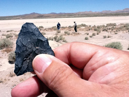
The approach holds great promise. In 2007, Comer cataloged sites on San Clemente Island, off Southern California. Using a simpler analysis, Comer found 90 percent of the island’s archaeological sites on about one-quarter of the island. Using the supercharged Hopkins model on a new area in the Mojave Desert, where sites are even more difficult to find, his preliminary results looked even better.
The potential? “We’re just beginning to understand,” Comer says, with a smile.