


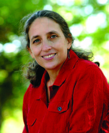
Ruth DeFries can see the forest through the trees, or more precisely, through satellite data.
DeFries, PhD ’81, has spent the better part of the past two decades using sophisticated satellite- imaging systems to obtain a clearer picture of the processes transforming our planet.
An environmental geographer, she uses this imagery to detect human modifications of the landscape and its impact on the biochemical processes that regulate the Earth’s habitability. She’s been able to observe land cover and land use change at regional and global scales to explore the implications on climate regulation, the carbon cycle, and biodiversity.
To honor her work, the John D. and Catherine T. MacArthur Foundation recently named DeFries a MacArthur Fellow. Often referred to as a “genius grant,” the award comes with $500,000 in no-strings-attached funding over five years.
DeFries, a professor at the University of Maryland College Park, has focused her research on land use in tropical regions, an area that has witnessed a substantial shift toward agriculture at the expense of forests. She initially studied Central Africa and moved on to map areas in Southeast Asia and the Brazilian Amazon.
“The tropics are a region in transition. It’s dynamic and rapidly changing,” she says. “We’re trying to understand precisely what is going on. We’re looking at the implications of deforestation and changes in the climate, specifically the levels of carbon emitted into the atmosphere.”
In the past, the deforestation rate was cobbled together using national statistics on forest cover and coarse-resolution satellite imagery, which didn’t always paint an accurate picture, DeFries says.
“We’re looking at the implications of deforestation and changes in the climate, specifically the levels of carbon emitted into the atmosphere.”Ruth DeFries
Recognizing the limitations of this approach, she and a team of collaborators developed a more precise methodology to map land cover using remote imaging data. With this method, DeFries has compiled spatially explicit datasets that have significantly changed the scale and focus of ecosystem research. The method allows scientists to make more plausible projections of future climate change and better understand how human activities alter habitats.
“We’re looking to develop the scientific underpinnings for land use and find that proper balance for what is best for us in the long run,” she says. “We tend to think in terms of economic benefit, but there are implications to be considered: How does land use impact ecosystems, climate, biodiversity, and water quality?”
Grace S. Brush, a Hopkins professor of geography and environmental engineering who was DeFries’ mentor at the Whiting School, says her former student capitalized on technical advances in satellite imagery to advance the field.
“Ruth is certainly very deserving of this award, for the truly elegant work she does,” says Brush. “She is very clear in her thinking, very smart, and I’m really happy that her work is being recognized.”