

Create
Design Project Gallery
Baltimore Spatial Optimization: Data-Driven Transit Planning and Vacant Lot Allocation
- Program: Civil and Systems Engineering
- Course: EN.560.402 Integrated Design Project
- Year: 2025
Project Description:
To help attract more visitors to the Baltimore Museum of Art and improve community well-being, this project analyzes the surrounding area using mobility, demographic, and land use data. Given Baltimore’s high number of vacant and abandoned lots, the model explores opportunities to convert these spaces into essential amenities, such as healthcare centers, schools, and grocery stores based on need. A genetic algorithm optimizes the placement of these amenities by incorporating walkability metrics, population density, and mobility patterns. Building on this, the model also identifies ideal locations for new bus stops, using the density of newly proposed amenities to enhance access. The result is a data-driven plan to improve local infrastructure, promote equitable development, and increase foot traffic to the museum by better serving surrounding communities.
Project Photo:
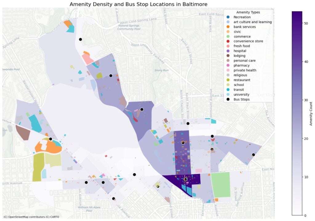
A map of the study area showing the current distribution of classified amenities, census boundaries, amenity density, optimal bus stop placements, and their relationship to amenity access and various demographic factors